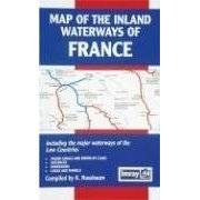
Map of the Inland Waterways of France: Including the Major Waterways of the Low Countries: Major Canals and Rivers by Class, Distances, Dimensions, Lo (地图)
 点此进入淘宝搜索页搜索
 特别声明:本站仅为商品信息简介,并不出售商品,您可点击文中链接进入淘宝网搜索页搜索该商品,有任何问题请与具体淘宝商家联系。
參考價格: 点此进入淘宝搜索页搜索分類: 图书,进口原版书,Sports(运动),Sports/Water Sports(水上与水中运动),Boating,
品牌: K. Nussbaum
基本信息出版社:SEAWORTHY PUBN INC (2001年7月1日)地图ISBN:0852885806条形码:9780852885802产品尺寸及重量:27.2 x 18 x 0.5 cm ; 105 gASIN:0852885806
商品描述内容简介Compiled by K Nussbaum. Including principal routes in Belgium and The Netherlands. This map shows the distances, numbers of locks and maximum draught and height of each navigation and is the only such map published in English. 1:1,500,000 folded or flat